Contact Us
Tuesday 13th September 2022 | Blog written by Gail Clark, OiQ’s Managing Director
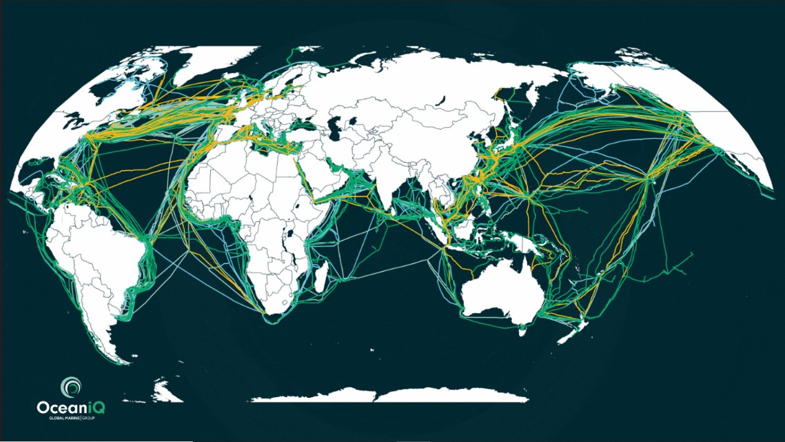
Our reliance on the intricate network of subsea cables continues to grow globally. It’s extraordinary to contemplate the phenomenal demand for data, which today penetrates every corner of the globe, recent data from Statista shows that in the last five years the percentage of the world population accessing the internet has increased by 19%. This mind-blowing statistic emphasises the importance of the 2.8 million kilometres of submarine fibre optic cable that makes such interconnectivity possible, also displayed in our subsea cable map.
If you combine this with the surging offshore wind market, which itself has seen a year-on-year increase of offshore wind turbines – a market that according to GWEC will see a further 235 GW of new offshore wind capacity being added to the global portfolio within a decade – and now sees this sustainable energy source expanding beyond its foothold in Europe, and gaining traction in both America and Asia. The scale of this submarine cable network only just becomes comprehendible. Mapping this complex submarine cable network is something that the OceanIQ team has been managing for decades, the team comprises a group of GIS specialists and, to be honest, data geeks that are impassioned by this all too impressive data set.
With a company history dating back to the formation of the submarine cable industry, as you’d expect we have some exceptional data covering the telegraph, coaxial and fibre optic eras, and which now also includes inter-array, export and interconnector cables as well. Our fondness for this data and sharing the insights within with our customers and the wider industry, has seen us evolve our offering to make it more accessible.
From September 1st, 2022, OceanIQ launches its very own online submarine cable map, with what we believe to be the most accurate data set available freely online. This generalised data goes way beyond other more illustrative offerings and shares some of the knowledge built by the Ocean IQ team over many, many years.
We have evolved our GeoCable data product too, introducing GeoCableLight, a secure web-based platform that enables a wider group of individuals to have view-access to the data set; making this industry-leading data set accessible beyond the traditional GIS and route engineering users. GeoCableLight is accessible on the move too, on mobile and on tablets, which yet again changes how this data can be digested.
This if course does not eliminate the requirement for access to the full GeoCable data set, this service has now been renamed GeoCablePro and remains the fully flexible professional option, which has been trusted by enterprises, governments, or multi-national bodies needing highly accurate data on cable locations and wanting to undertake complex analysis and data planning themselves.
Both GeoCablePro and GeoCableLight are subscription-based, with information that is regularly updated – giving users the added peace of mind that their investment as subscribers will always give them up-to-date data and information.
For further information, visit www.oceaniq.co.uk or www.oceaniq.co.uk/submarinecablemap or contact me directly gail.clark@oceaniq.co.uk as I, like my wider team, would be delighted to discuss the attributes of this impressive data set in more detail with you. And how you access the subsea cable map, either via GeoCableLight or GeoCablePro, could increase your company’s knowledge, planning abilities, and business efficiency.
 Author: Gail Clark
 OceanIQ’s MD, Gail Clark talks about her team’s fascination and passion for data