Contact Us
Monday 18th March 2024
For a quarter-century, GeoCable® has led the way in mapping, monitoring, and logging subsea cable installation and faults. Leveraging both current and historical data, GeoCable® assists operators in planning new cable installations, facilitating repair operations, predicting potential issues, and enhancing the overall reliability of subsea cable systems.
This invaluable resource is essential for stakeholders in range of marine industries, including renewable energy, power, telecommunications, and surveying.
In the past 25 years, we’ve witnessed a remarkable transformation in subsea fibre optic cables. The proliferation of cables on the ocean floor has significantly increased to accommodate escalating bandwidth demands. New cable deployments have interconnected continents and regions, bolstering communication and data transfer capabilities.
Notably, traditional transatlantic and transpacific routes have seen the addition of new cable systems, along with previously underserved or unconnected areas, heightening global network redundancy and resilience.
In celebration of GeoCable’s 25th anniversary, we’re excited to share some of the interesting statistics that we’ve recorded over the last 25 years.
1. OceanIQ manages a wealth of detailed submarine cable data, spanning well over 170 years of information. The earliest cable in our GeoCable® database dates to 1851. This was the first commercial cable ever installed and ran from England to France.
2. The database contains approximately 97% of the world’s in service and out of service cable systems.
3. There are over 850 in service cable systems comprised of over 2500 individual segments included in the database.
4. Our data provides detailed insights into over 2.8 million kilometres of subsea telecommunications cable.
5. GeoCable® contains data on enough cable to circle the equator 71 times.
6. And enough cable to stretch to the moon 7.4 times.
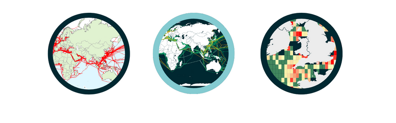
7. In December 2021 Power GIS layer and Cable Heat Maps became available to customers.
8. 40,000 kilometres of power cable routes are held in our database, enough to circle the equator.
9. There have been 4,101 cable repairs in the last 25 years.
10. Over 5000 historical cable faults were used in the creation of our cable fault Heat Maps.
11. 2022 OiQ launched GeoCable® Light and GeoCable® Pro services.
12. Approximately 80% of routes are plotted using as-laid coordinates. Where we don’t have as laid coordinates, we utilise other sources such as vessel positions and cable awareness data.
13. Our team constantly update the databases and issue regular updates to subscribed members. On average there are 50 updates to the GeoCable® database per month.
14. The GeoCable® database as well as having commercial cables also features many cables used for scientific purposes.
Examples:
15. The database also features some cables used specifically for monitoring the Comprehensive Nuclear-Test-Ban Treaty.
(How is sound used to monitor nuclear testing? – Discovery of Sound in the Sea (dosits.org)
Station Profiles | CTBTO)
16. Approximately 250,000km of submarine telecommunications cable is buried into the seabed.
17. PTAT-1 was the first privately financed transatlantic fibre optic telecommunications cable, which was completed in 1989, at a cost of US$400 million. Covering a distance of 7,552 kilometres (4,693 miles; 4,078 nautical miles). The significance of PTAT-1 is that it broke the international telecommunication monopoly held by AT&T Corporation and British Telecom (BT) for telecommunications between the US and UK. The UK to US section of the cable was shut down on the 8th of February 2004, as it was no longer considered financially viable by Cable & Wireless.
18. A significant portion of PTAT-1 has been repurposed and redeployed for the US-Bermuda system. Underscoring the importance of recording the process of cable recovery in our database management.
19. Approximately 9.3% (105,000km) of out of service cable has been recovered for recycling or repurposing as new systems.
20. 95% of countries with a shoreline have at least one cable landing.
21. Currently, the USA boasts over 80 operational cable landings, holding the highest number globally.
22. There have been a total of 60 cables that have crossed the North Atlantic. 21 of which are still in service.
23. There have been 28 cables crossing the North Pacific. 20 of which are still in service.
24. The deepest submarine cable goes down to approximately 9700m water depth.
25. The only continent currently not connected by cable is Antarctica.
GeoCable® boasts an unmatched compilation of subsea cable data meticulously curated and continually refreshed over many years. Responding to increasing interest from diverse business sectors beyond conventional GIS teams, we have expanded the scope of GeoCable® offerings. Our enhanced GeoCable® dataset is conveniently accessible through our complimentary submarine cable map or via subscription services like GeoCable®Light and GeoCable®Pro, tailored to accommodate varying user requirements. For further details on these product options, please click here.