Contact Us
Wednesday 18th January 2023 | Blog written by Neil McLauchlan, Route Engineer
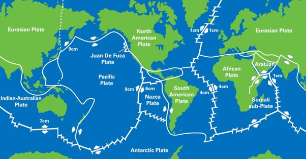
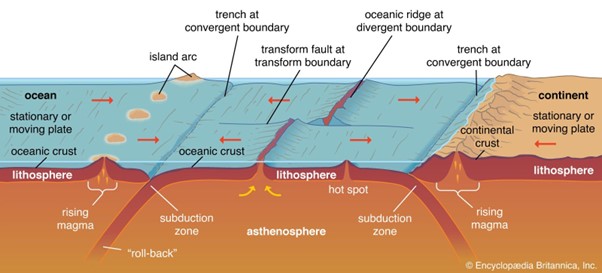
Plate tectonics is a scientific theory that tries to explain the dynamics of the Earth’s outer crust (lithosphere) over the ductile upper mantle (asthenosphere). Within the lithosphere is a rigid layer of crust that is generally split into two types: continental crust, which is predominantly granitic in nature, is relatively buoyant and between 100-200km thick; and oceanic crust, which is predominantly basaltic in nature, more dense and between 6-100km thick. The lithosphere also includes a rigid part of the upper mantle that is mainly peridotite in composition and is separated from the crust by the “Mohorovicic” Discontinuity (Moho), a change in the rock’s chemical composition between crust and mantle.
As a Route Engineer, it’s important to have a basic understanding of the theory and by-products of plate tectonics. They’re just one of many external forces and aggravations impacting a cable. Being aware of all of these impacts enables us to safely engineer a subsea cable route for our customers, that will remain secure and damage-free long into the future.
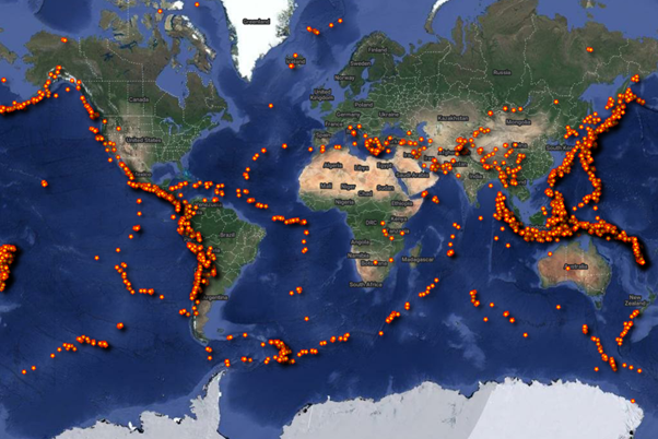
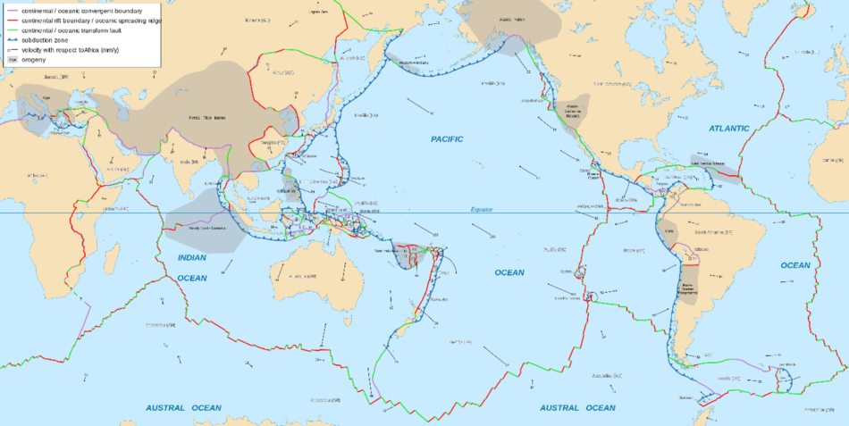
A plate is a section of continental or oceanic lithosphere that has a different composition or movement style to others around it. Currently, most tectonic plates move at a rate between approximately 1-6cm/year. However, some sections of the East Pacific Rise reach spreading rates up to 17cm/year. Scientists use multiple techniques to define the boundaries of plates. The most common way to define boundaries is to use an earthquake epicentre map and an active volcano map, as these are by-products of plate tectonics. When you overlay the maps, a definitive pattern emerges.
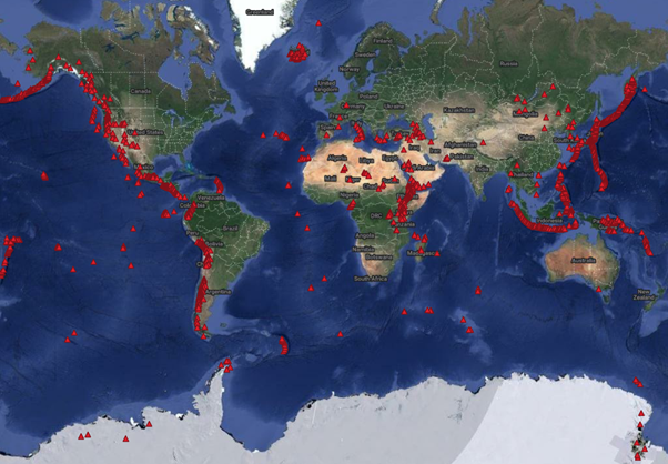
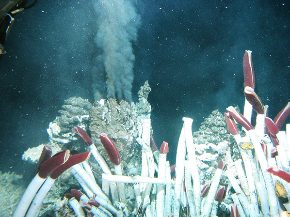
Along with earthquakes and volcanoes, other by-products of plate tectonics can include: landslides; tsunamis; expansion/collision/transform movement rates; oceanic trenches; as well as hydrothermal vents and the associated chemosynthetic organisms. All of which can impact, often negatively, the precious cable assets which are on the seabed connecting islands, countries and continents together, and must therefore form a part of the cable route engineering process. The vents and biodiversity they accommodate are starting to fall under maritime conventions as more countries engage in protecting marine biodiversity within their waters, forming an increasing number of obstacles on the sea floor which need to be fully understood and factored in to cable route planning. Our Cable Protection Assessment, Cable Fault Database and Charting Services all support this understanding and form the basis of a solid solution.
References:
BGS, 2022. What causes earthquakes? British Geological Survey. Available at: https://www.bgs.ac.uk/discovering-geology/earth-hazards/earthquakes/what-causes-earthquakes/
GeolSoc, 2022. Plate Tectonics. The Geological Society. Available at: https://www.geolsoc.org.uk/Plate-Tectonics
Global Volcanism Program (GVP), 2022. [Database] Volcanoes of the World (v. 5.0.0; 1 Nov 2022). Distributed by Smithsonian Institution, compiled by Venzke. Available at: https://doi.org/10.5479/si.GVP.VOTW5-2022.5.0
Global Volcanism Program (GVP), 2022 [1]. Image Gallery for Submarine Volcanoes. Distributed by Smithsonian Institute. Available at: https://volcano.si.edu/gallery/ImageCollection.cfm?gallery=VolTypeSubmarine
Johnson, C., et al., 2017. An Introduction to Geology. Chapter 2 Plate Tectonics. Salt Lake Community College. Available at: https://opengeology.org/textbook/
King, H., 2005. Plate Tectonics. Geology.com. Available at: https://geology.com/plate-tectonics/
NOAA, 2022. What are the different types of plate tectonic boundaries? National Oceanic and Atmospheric Administration: Ocean Exploration. Available at: https://oceanexplorer.noaa.gov/facts/plate-boundaries.html
USGS, 2014. Understanding plate motions. US Geological Society. Available at: https://pubs.usgs.gov/gip/dynamic/understanding.html
USGS, 2022. [Database] Earthquake Data. Available at: https://www.usgs.gov/programs/earthquake-hazards/science/earthquake-data van Andel, T. H., 2022. Plate tectonics. Encyclopaedia Britannica. Available at: https://www.britannica.com/science/plate-tectonics
 Author: Neil McLauchlan, Route Engineer
 Neil is one of OceanIQ’s experienced Route Engineers