Contact Us
Friday 8th October 2021
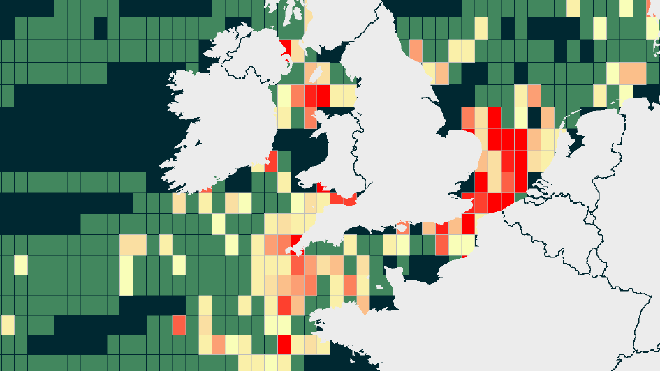
Understanding the submarine cable landscape has never been as important as it is now. At OceanIQ®, we can now provide you with detailed fault rate heat maps, additional subsea cable data and visuals that outline the number of faults that can be expected on each kilometre of a cable, within a specific area, per year and aid in better cable route planning, longevity and profitability.
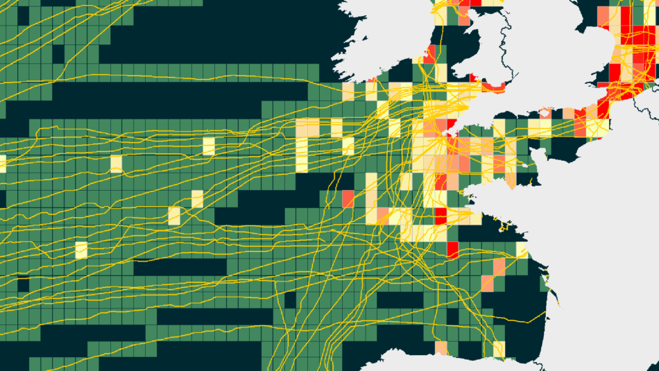
Utilising our cable database, analyse 6,000 historical global cable faults to easily identify areas of high fault rates, overall minimising system downtime.