Contact Us
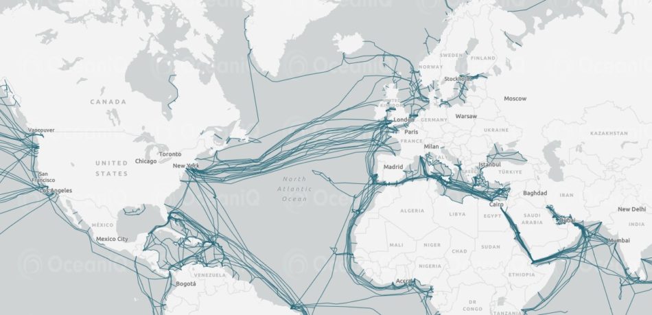
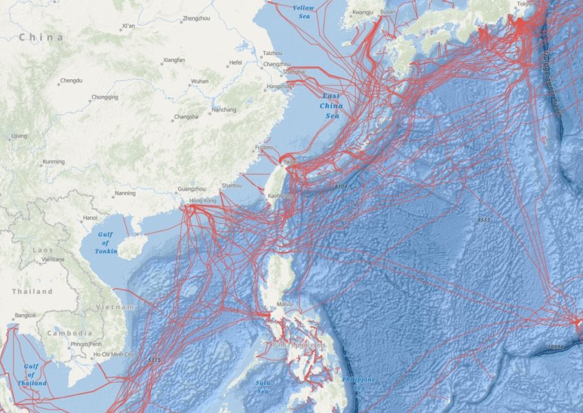
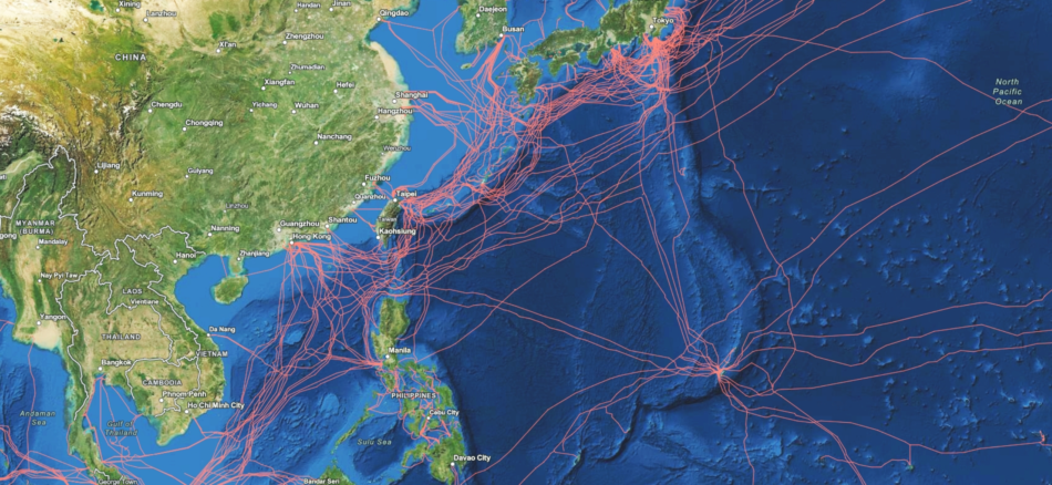
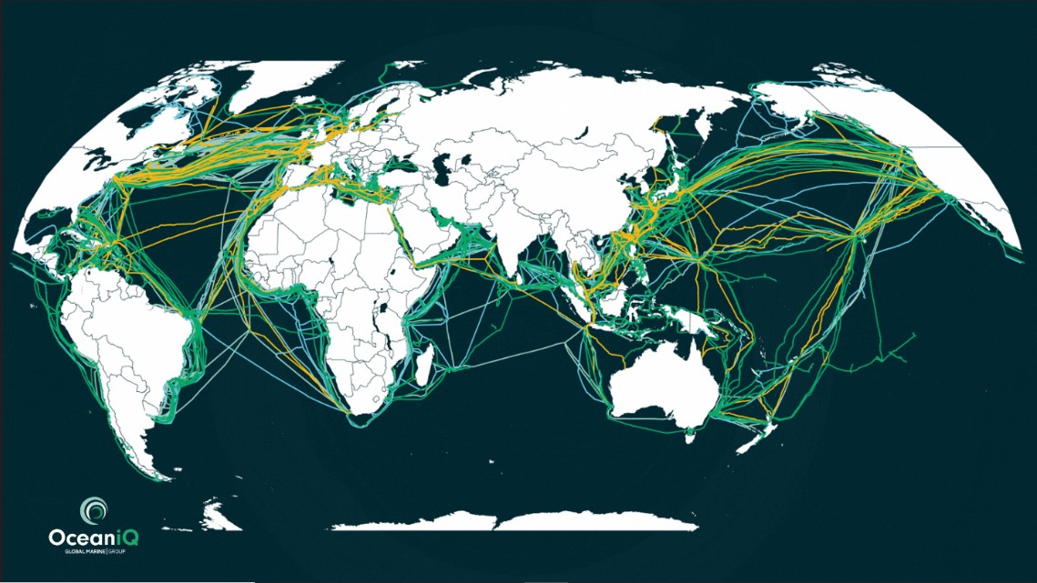
OceanIQ prides itself on its extraordinary set of subsea cable data that it has managed and updated over many decades. The team has recently expanded the product range to accommodate increasing interest for wider business consumption outside of the traditional GIS teams. A range of products that cater for a broad spectrum of customers, developed by the team, now enable entire organisations to have access to this highly important data. The GeoCable data set is available through our free submarine cable map, or via GeoCable®Light or GeoCable®Pro subscription services.
Below is an easy guide outlining what is available through each service, so you can decide which service best suits your business requirements.
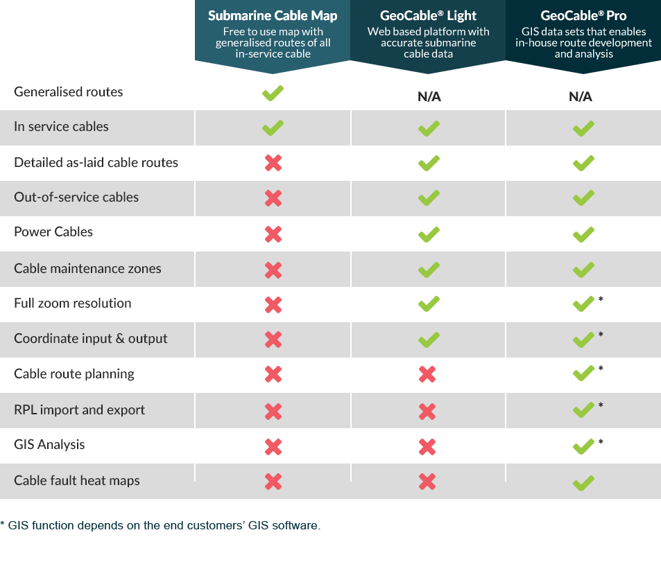
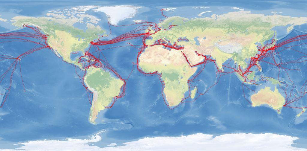
Free to use and accessible for all, this map details generalised routes for all in-service fibre optic cables. We believe it to be the most accurate platform available to the general public today.
Today, a dedicated team ensures these records are kept up to date, with the data underpinning marine activities for many users – including cable installers and owners, governments and ship operators.
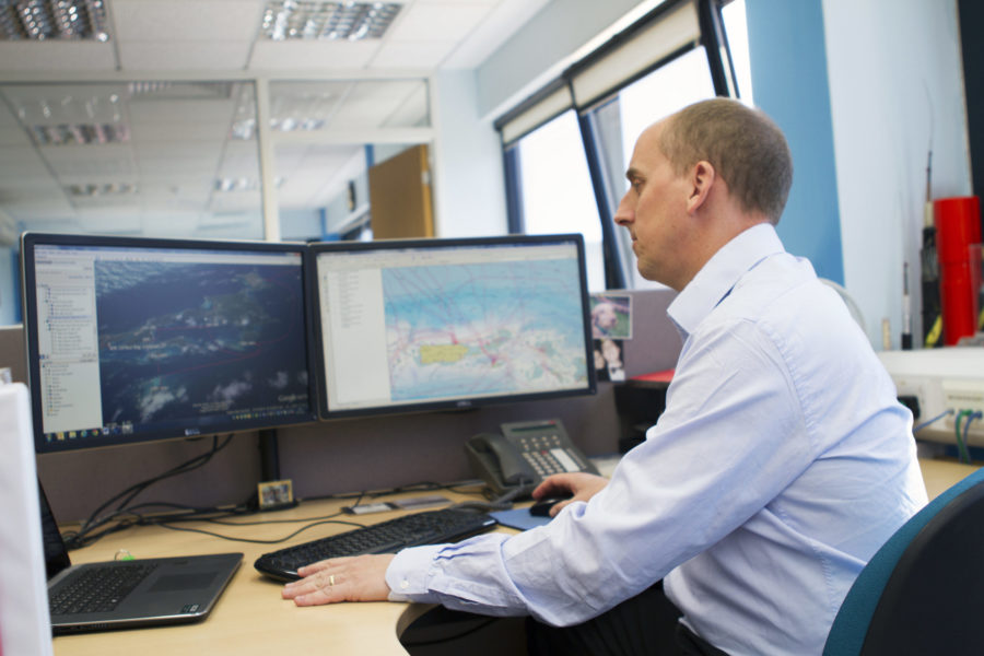
If you can’t find the information you need on our free Submarine Cable Map, the recently launched GeoCable®Light available on a user-friendly web-based platform might be the right solution for you or, for GIS specialists, GeoCable®Pro provides data that can be used on ESRI, Makai, or on OceanIQ’s own GeoCable®software.
This data source is accessible to all, for free.
A web-based platform to access accurate submarine cable route data, with no GIS training required. Data can be layered up to include the latest in-service fibre optic systems, out-of-service fibre optic, coaxial and telegraph cables.
It’s accessible and intuitive, and the online platform prevents the necessity of purchasing costly GIS software and undertaking the relevant training.
To get free 24-hour access to the demonstration site to assess whether this informative tool would benefit your business, contact info@oceaniq.co.uk. The sign-up process is simple, so we can give you and your team access quickly.
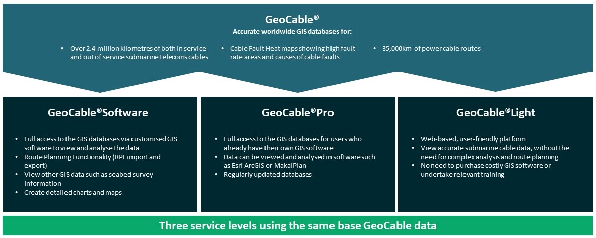
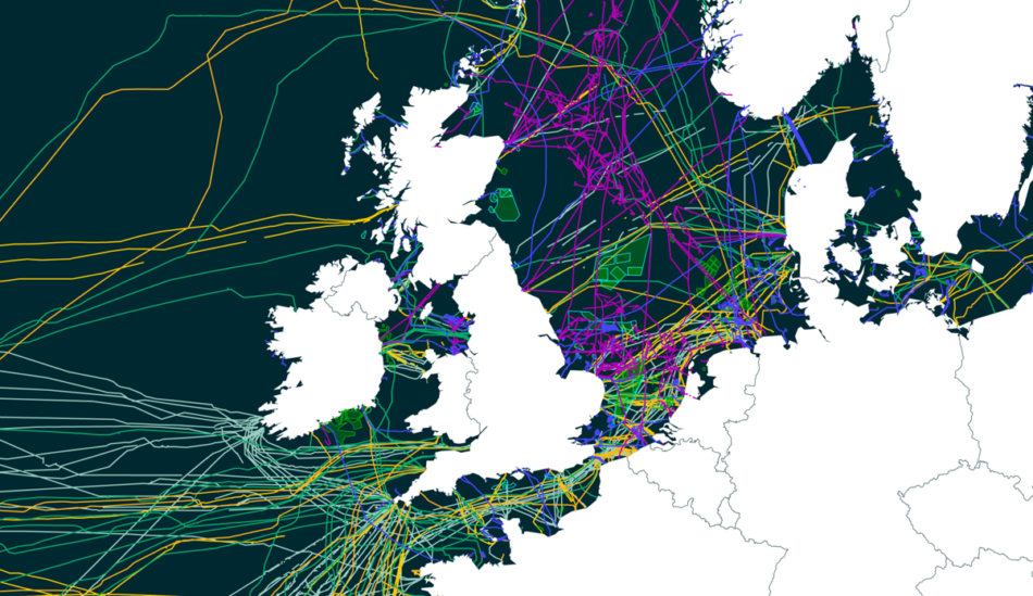
With GeoCable®Pro, you get subscription access to over 3 million km of rich submarine cable data
GeoCable has been renamed GeoCable®Pro to make space in OceanIQ’s suite of products for the recently launched web-based platform, GeoCable®Light. GeoCable®Pro accesses over 3 million km of rich submarine cable data and is available on a subscription basis for customers who wish to develop cable routes in-house, analyse the data and create RPLs within GIS software packages.
If you would like more details on this data set, or to be able to question existing users to fully understand how GeoCable®Pro could benefit your organisation, please contact info@oceaniq.co.uk.
GeoCable® GIS Software offers route planning functionality with RPL generation in a comprehensive software package for effectively managing and analysing project requirements.
Provides a wealth of subsea cable data at your fingertips, enabling systems to be safeguarded long into the future
Take a look at our other Cable Route Planning Services
High quality survey data is the cornerstone of all engineering projects. OceanIQ’s experienced survey team manages marine surveys on behalf…
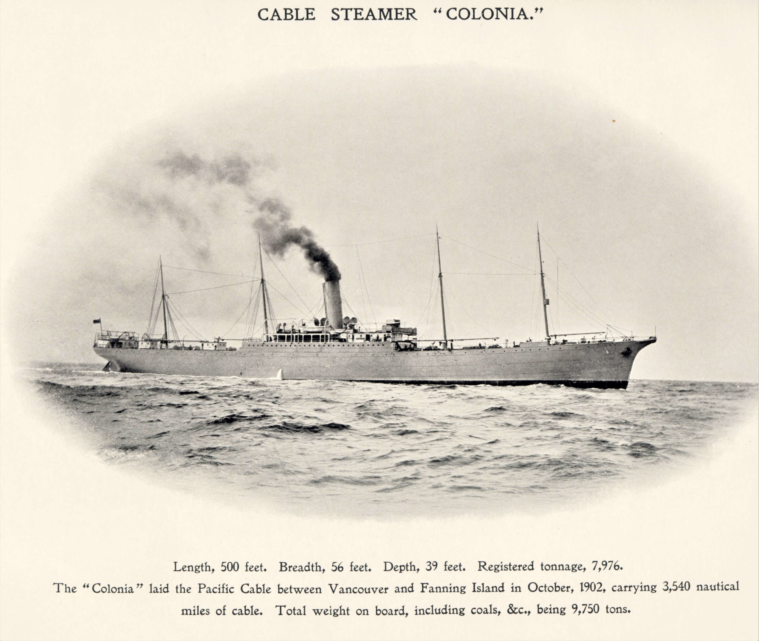
With involvement in the installation and maintenance of subsea cable since the formation of the industry back in 1850, OceanIQ…
We evaluate, advise on, navigate and complete the complex and varying multi-national permit requirements for projects worldwide ensuring that your…
OceanIQ’s® route engineering department draws upon decades of installation and maintenance experience with the latest cable routing software to provide…

What an amazing milestone for Stuart, us as a team here at OceanIQ as well as for our customer who benefit from Stuart’s vast experience, knowledge and passion for his role. Hear more from Stuart when we caught up with him about his 25 year work...

After sharing historical cable fault data for use in a study, OceanIQ Managing Director, Gail Clark, recently discussed fault prediction, collaboration with the fishing industry, and the use of historic data for future cable trend analysis with TeleGeography. Read the full conversation here: How is OceanIQ’s...
Determining reliable cable ampacities for marine High Voltage Cables is currently the subject of significant industry and academic reassessment in order to optimise the operation (ampacity), design (cross-sectional area) and subsequent efficiency, longevity, CAPEX and profitability of both submarine power cables and their dependencies (Enescu et...
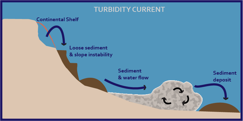
When sediment becomes suspended within a mass of water and this increase in density causes the water body to begin moving downslope under the influence of gravity this is termed a turbidity current – and they can be a cause of subsea cable faults. These high-energy...
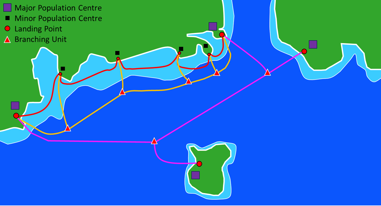
From the earliest stages of a new subsea cable project, understanding the pros and cons of utilising branching units or a festoon system is vital from a system design and cable security point of view. In many cases, the preference of one over the other will...

Climate-induced phenomena—such as rising sea levels, increased frequency and intensity of storms, storm surges and coastal erosion —threaten subsea cable networks. This paper will describe the changes to human activities as a result of climate change and adaptive strategies for enhancing the resilience of subsea cables...
Massive volcanic landslides are some of the largest landslides on Earth, which have several potential primary and secondary effects on submarine cable systems. These effects can be managed effectively with smart subsea cable route engineering which factors in all the influences on a cable to ensure...
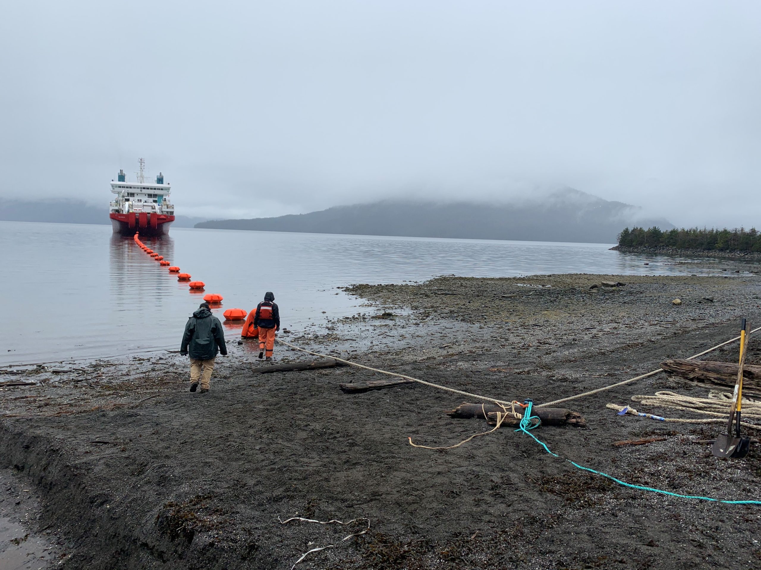
Deploying submarine cables involves several stages including route planning, marine survey, operational permitting, cable system design, cable manufacturing, marine lay and commissioning. OceanIQ regularly support our sister company Global Marine, also part of the Global Marine Group, with consultancy and route engineering services related to survey...
For a quarter-century, GeoCable® has led the way in mapping, monitoring, and logging subsea cable installation and faults. Leveraging both current and historical data, GeoCable® assists operators in planning new cable installations, facilitating repair operations, predicting potential issues, and enhancing the overall reliability of subsea cable...
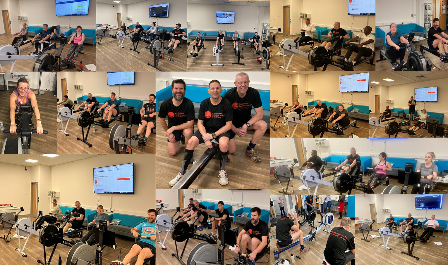
We take immense pride in recognizing the outstanding achievement of our GMG rowing team members – Dave Dunk, Craig Beech and Spike Johns. They successfully conquered the challenging task of rowing 1,000,000+ metres in January as part of the wider rowing community ‘Concept2’ team challenge. Impressively ranking first on the...
As trusted custodians of over 3 million kilometres of rich subsea cable data, OceanIQ are delighted to celebrate this landmark 25th GeoCable® anniversary. Over 25 years the GeoCable® dataset has continuously evolved and is now accessible through our complimentary submarine cable map, or via subscription services...
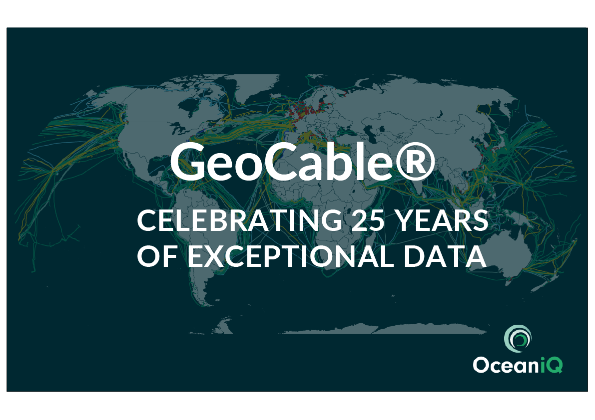
Celebrating 25 years of exceptional data insight. The evolution of the submarine cable industry during this timeframe. For 25 years GeoCable® has been at the forefront of subsea cable mapping, monitoring, and logging subsea cable installation and faults. GeoCable’s subsea cable map of up to date...
Big charity challenges are a regular event at Global Marine Group. 2023 was no different with the MeaNDa walking challenge raising funds for the Motor Neurone Disease Association.
Captain John Tollady and Officers from the Cable Retriever, share their account of a long overdue visit to the charity.
Route Engineer James Rygate joined an interactive panel recently to introduce and refresh individuals to the subsea cable industry.
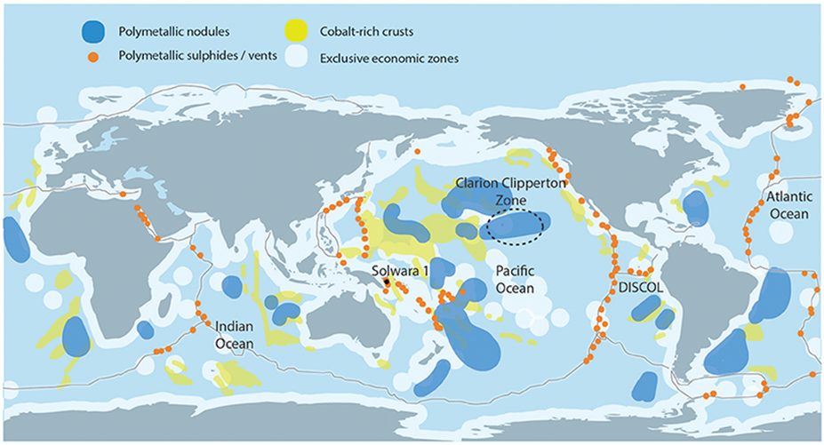
Hydrothermal vents are commonplace along mid-ocean ridges and hotspots. Vents are fractures on the seafloor that allow the transfer of energy and minerals through a hydrothermal system consisting of porous rocks or pre-existing planes of weakness, before being ejected into the water column.
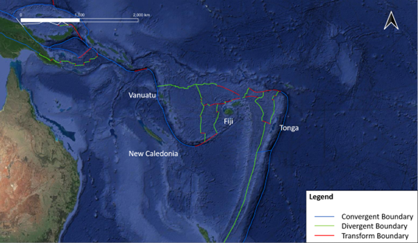
Marine boundary zones act as a focal point of hazards, such as: volcanoes; earthquakes; tsunamis; landslides; hydrothermal vents; liquefaction; and fissures, to name a few.
Earthquakes are commonplace along transform boundaries. Earthquakes can cause several hazards to cable routes: liquefaction can occur in seafloor sediments causing the cable to be buried deeper or exposing it at the surface; movement of sediment in landslides can damage the cable as deposition occurs; landslides...
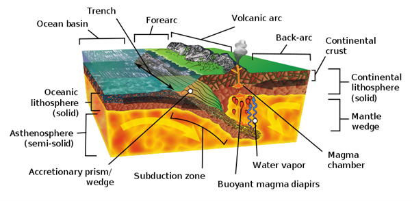
The Mariana Trench is an extreme example of a trench created at a subduction zone along a convergent boundary.
Being an on-site representative for a cable project is an important role. It can satisfy important permit conditions but also allow for instant feedback to issues that arise, and facilitate communications.
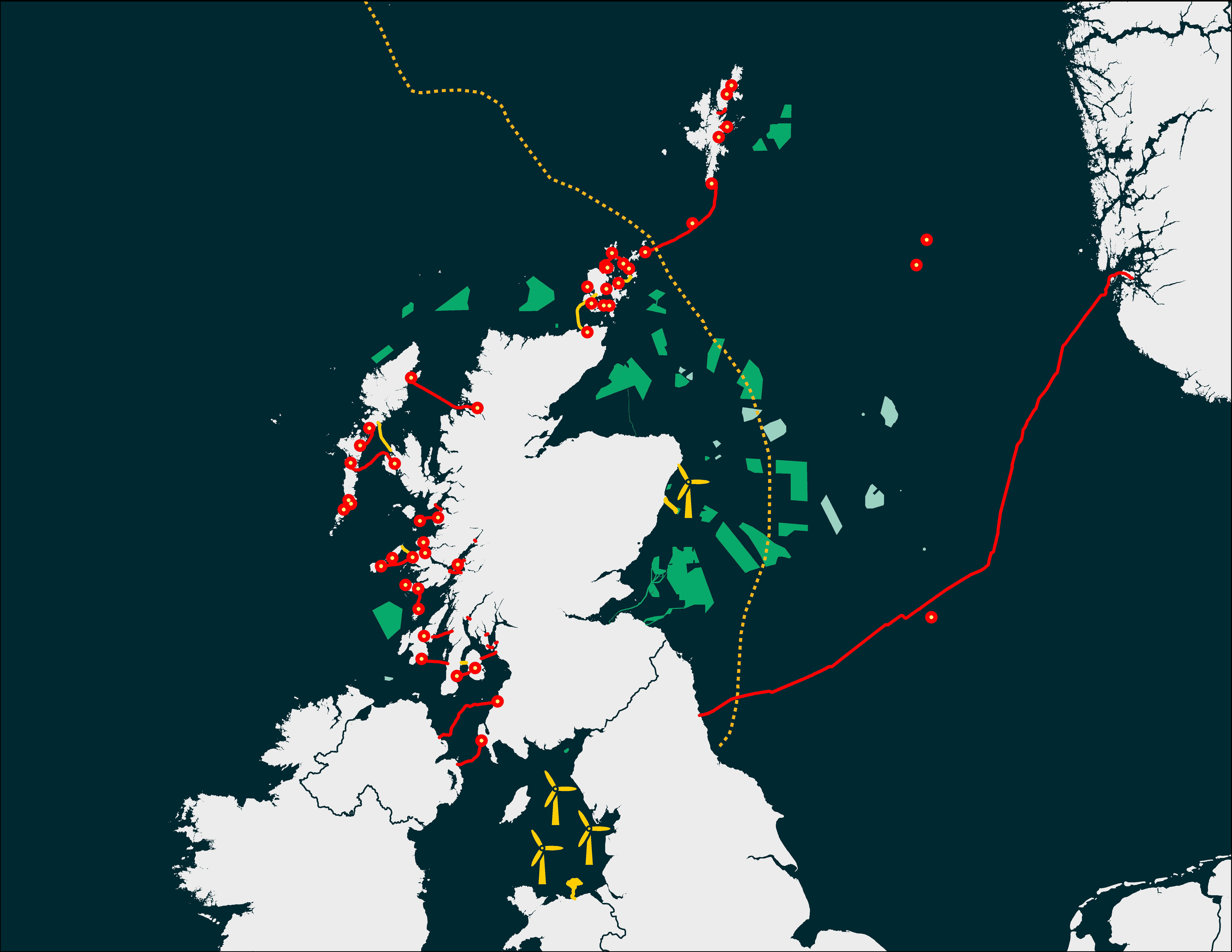
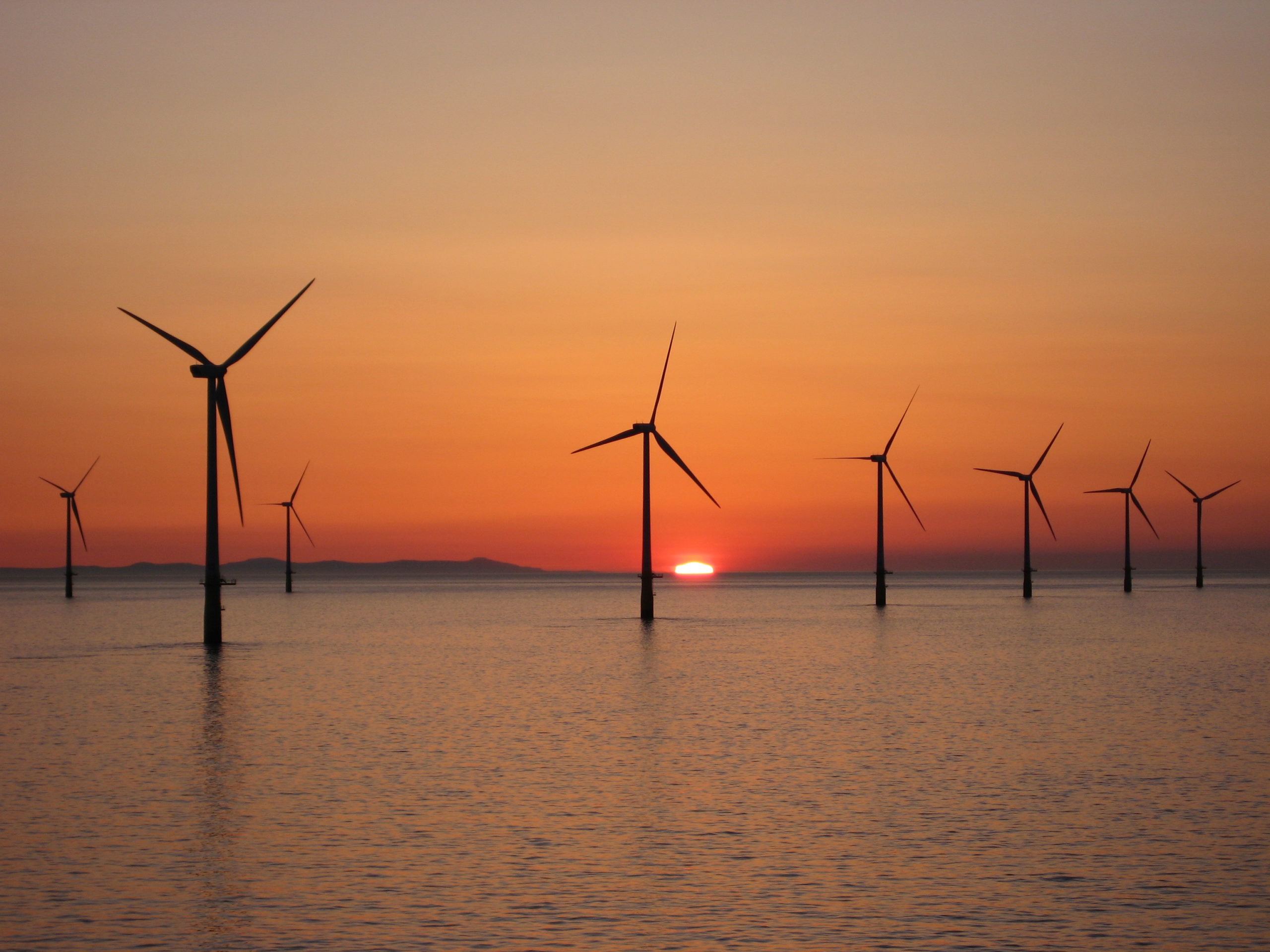
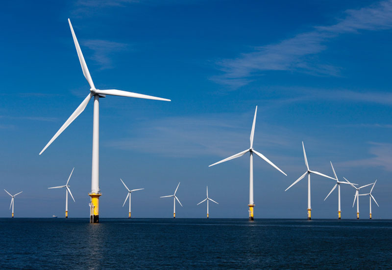
We know Scotland, and we know Offshore Renewables. Find out more about our experiences than can help in the upcoming ScotWind campaign.
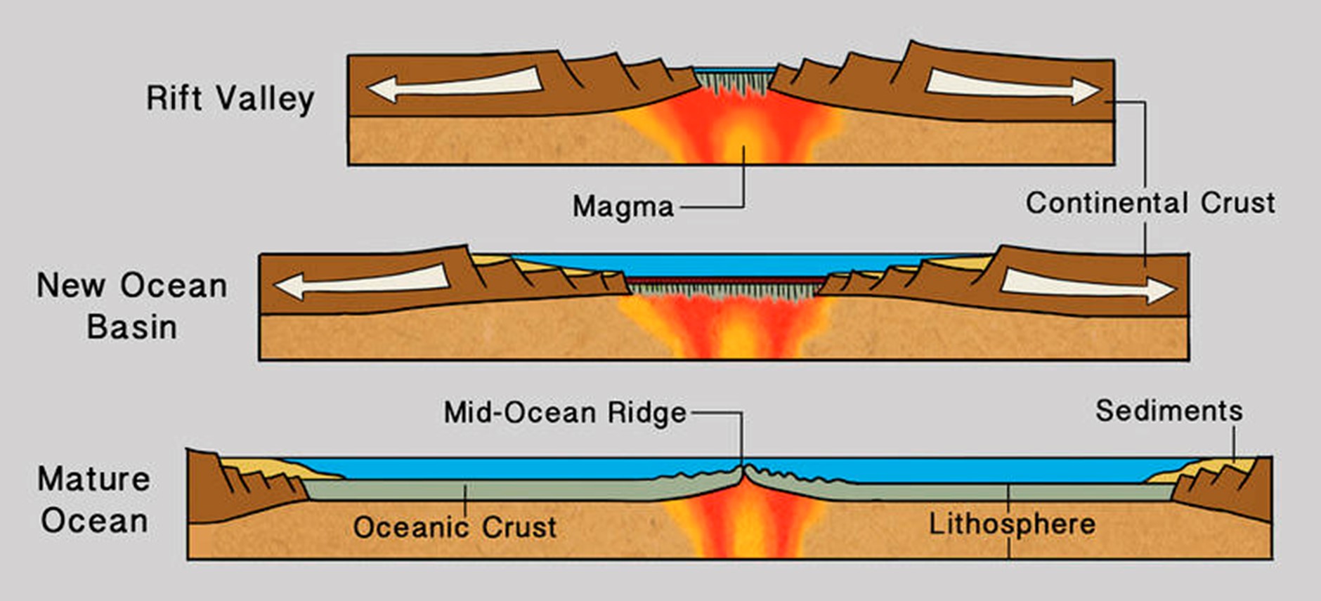
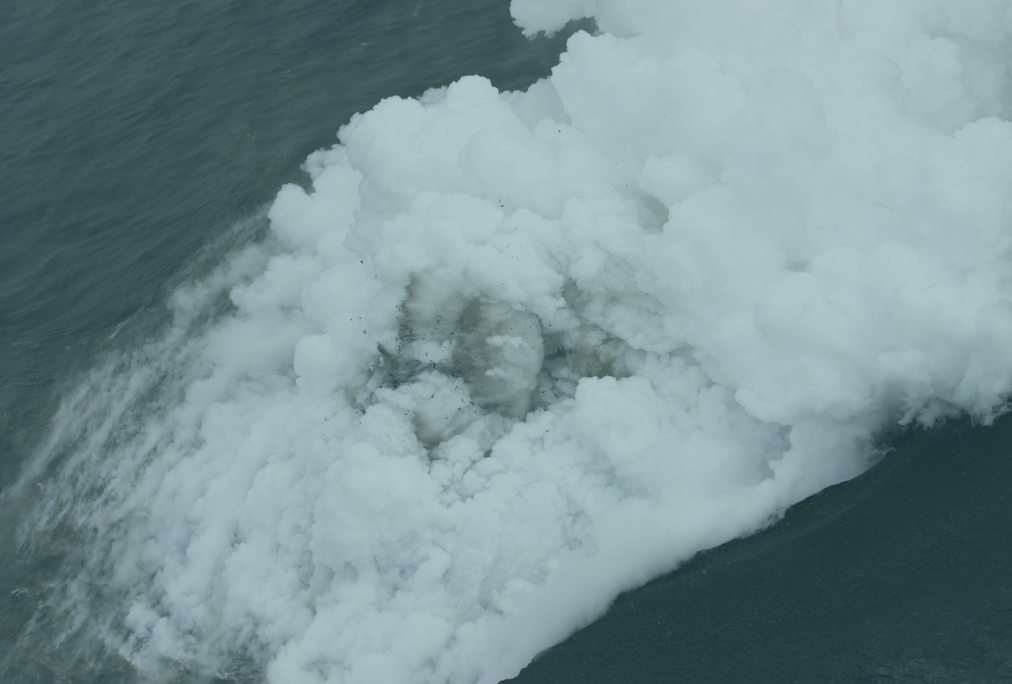
Not only are eruptions difficult to predict - when and where they occur - but if a new fissure is created a cable could become suspended, suffer abrasion damage and there's the associated seismic damage that could occur.
Hear from our Permitting & GIS Manager, Brian Perratt, in this great article recently published in PES (Power & Energy Solutions) magazine
The sea floor is constantly changing, whether from growth in flora and fauna, habitats, wildlife, human intervention or geological reasons.
Chloe joined our Permitting team a few years ago but has already discovered the intensity of permitting for clients around the world.
Our Permitting Manager Alex discusses his experiences in managing the complex and varying role of permitting, for clients all over the world.
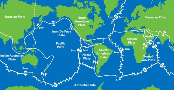
All of our our Route Engineers have a basic understanding of plate tectonic theory, and the by-products of plate tectonics, to enable us to safely engineer a subsea cable that will remain damage free long into the future.
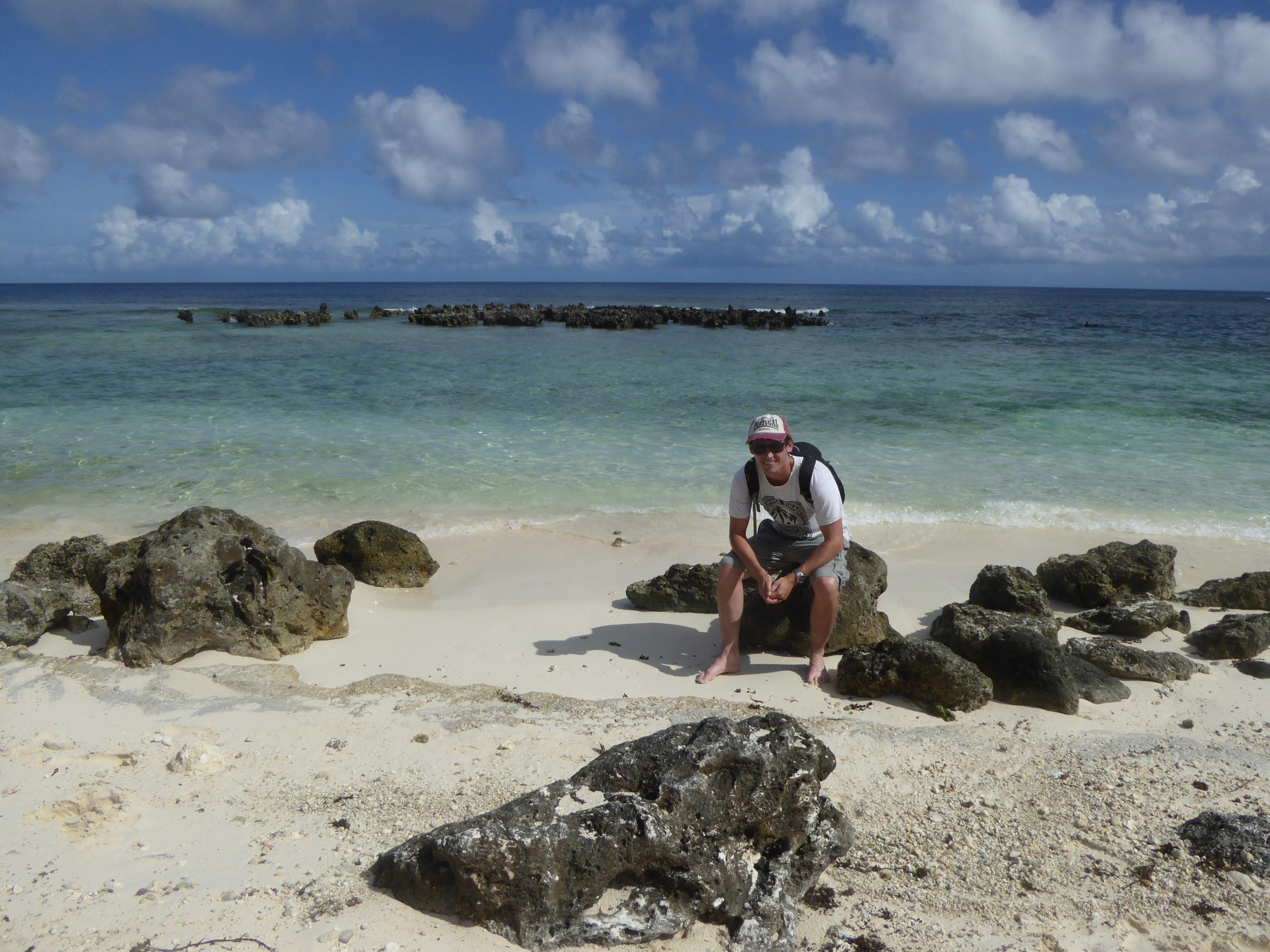
Route Engineer James Rygate discusses the factors that developers need to consider when planning cable routes around existing seabed infrastructure
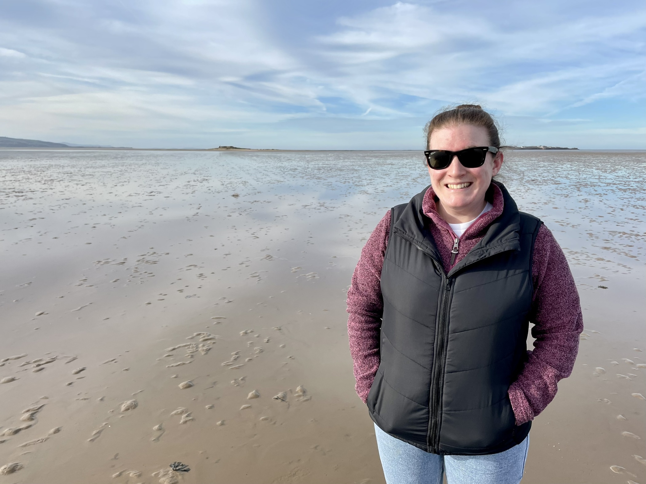
OceanIQ's MD Gail Clark, looks at the intricacies of the seafloor, and how important understanding them really is
From today, OceanIQ launches a series of new products, making its unrivalled database of submarine cable data even more accessible.
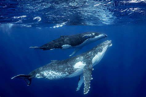
Matthew West, Route Planning Manager, explains how OceanIQ’s data helps to avoid accidental harm to vulnerable marine mammals.
Route Planning Manager, Matthew West, looks at how OOS cable date is used to help the efficient deployment of new installations worldwide.
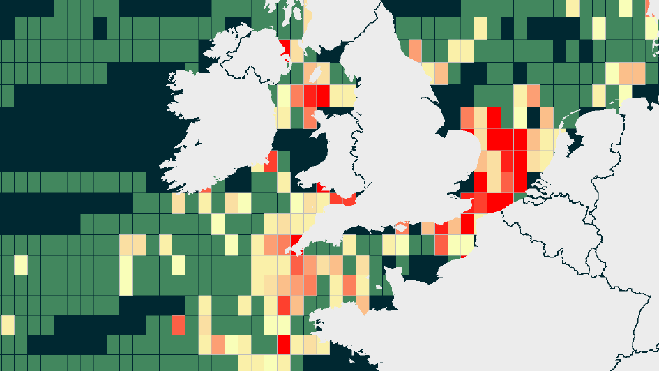
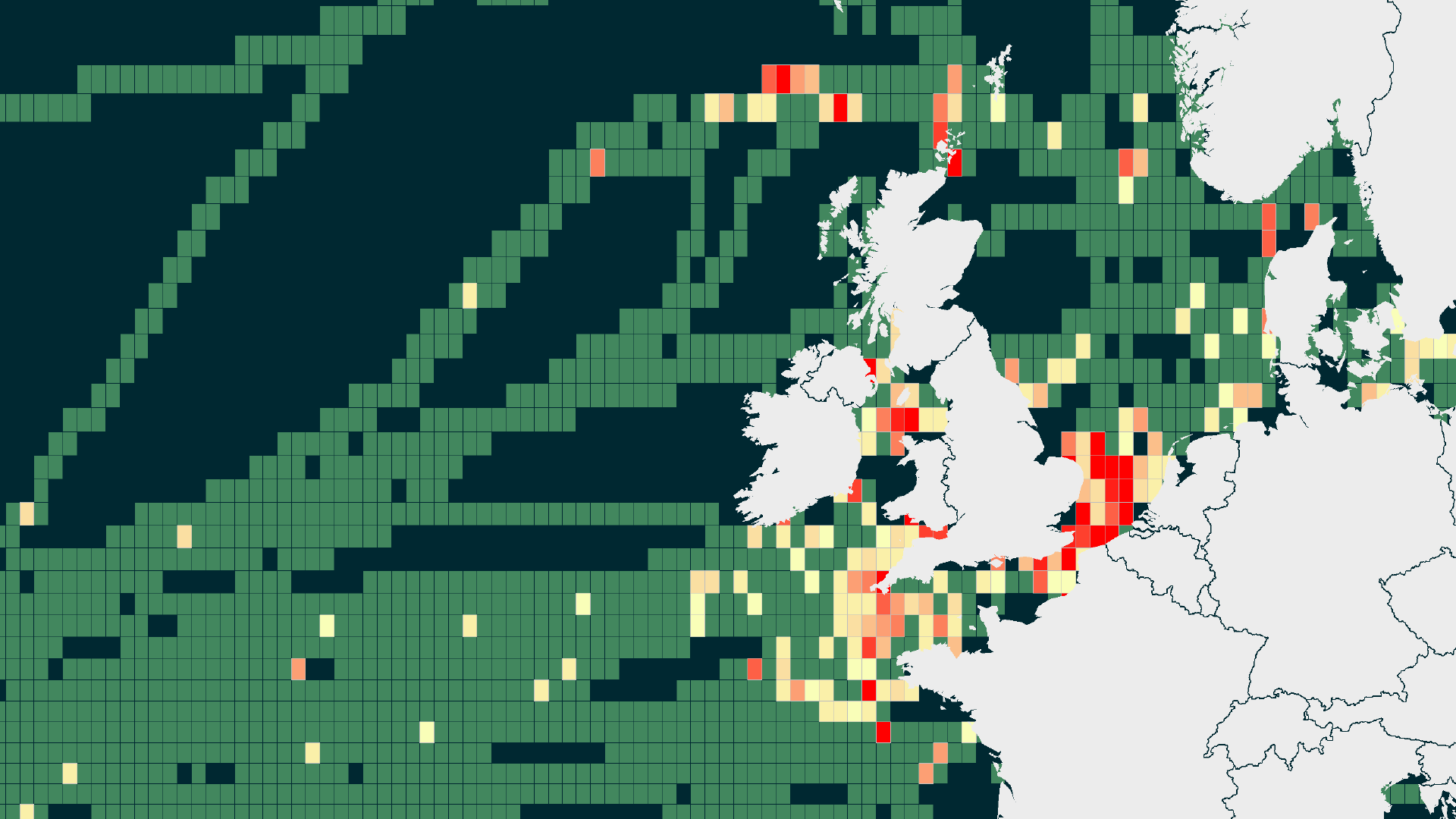
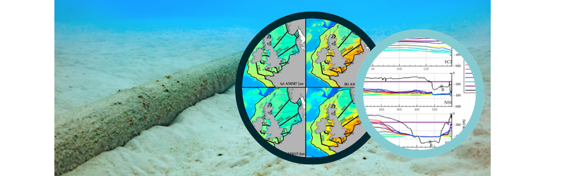
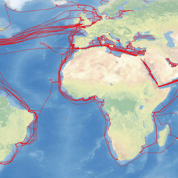
Introducing GeoCable® GIS Cable Fault Rate Heatmaps Understanding the submarine cable landscape has never been as important as it is now. At OceanIQ®, we can now provide you with detailed fault rate heat maps, additional subsea cable data and visuals that outline the number of faults that...

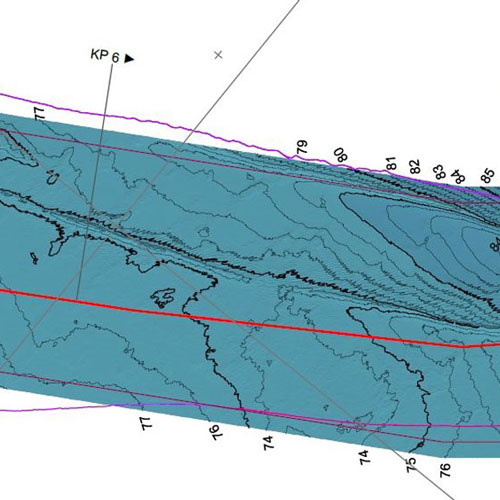
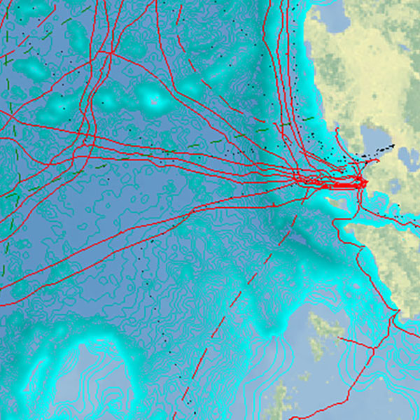
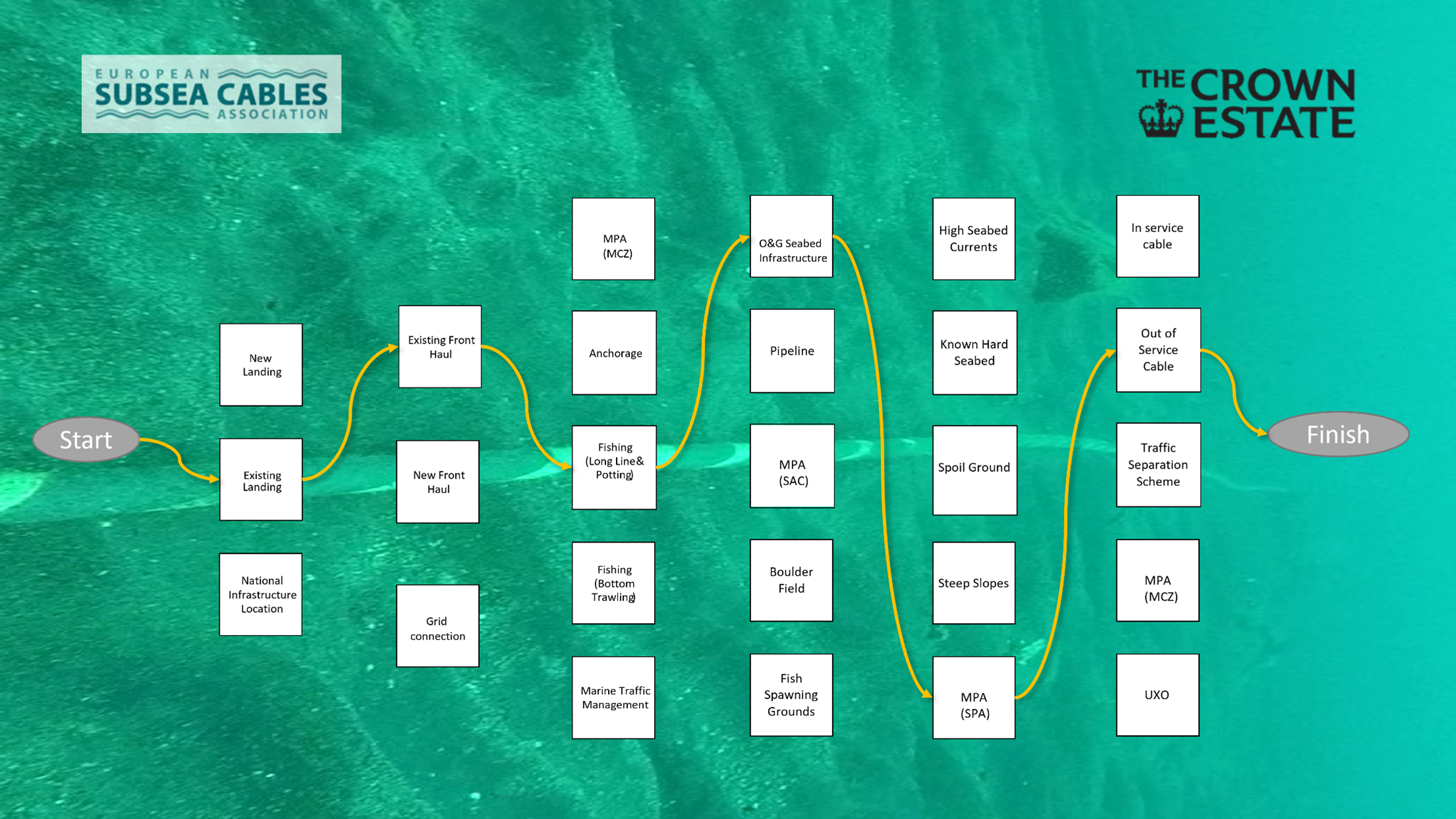
The Challenges of Cable Crossings Pre-project Planning is Key When planning new cable systems, dealing with cable crossings can be complex and if preparation is done incorrectly, can result in huge repair costs for existing cables in the surrounding infrastructure. Submarine cable maps help identify the...
Global Marine has completed the initial subsea fibre-optic cable route survey scope for the Scottish Government’s Reaching 100% Programme (R100), being delivered by Openreach on behalf of BT. The project covers inter-island connections between Orkney, Shetland, and the Inner Hebrides as well as two connections back...
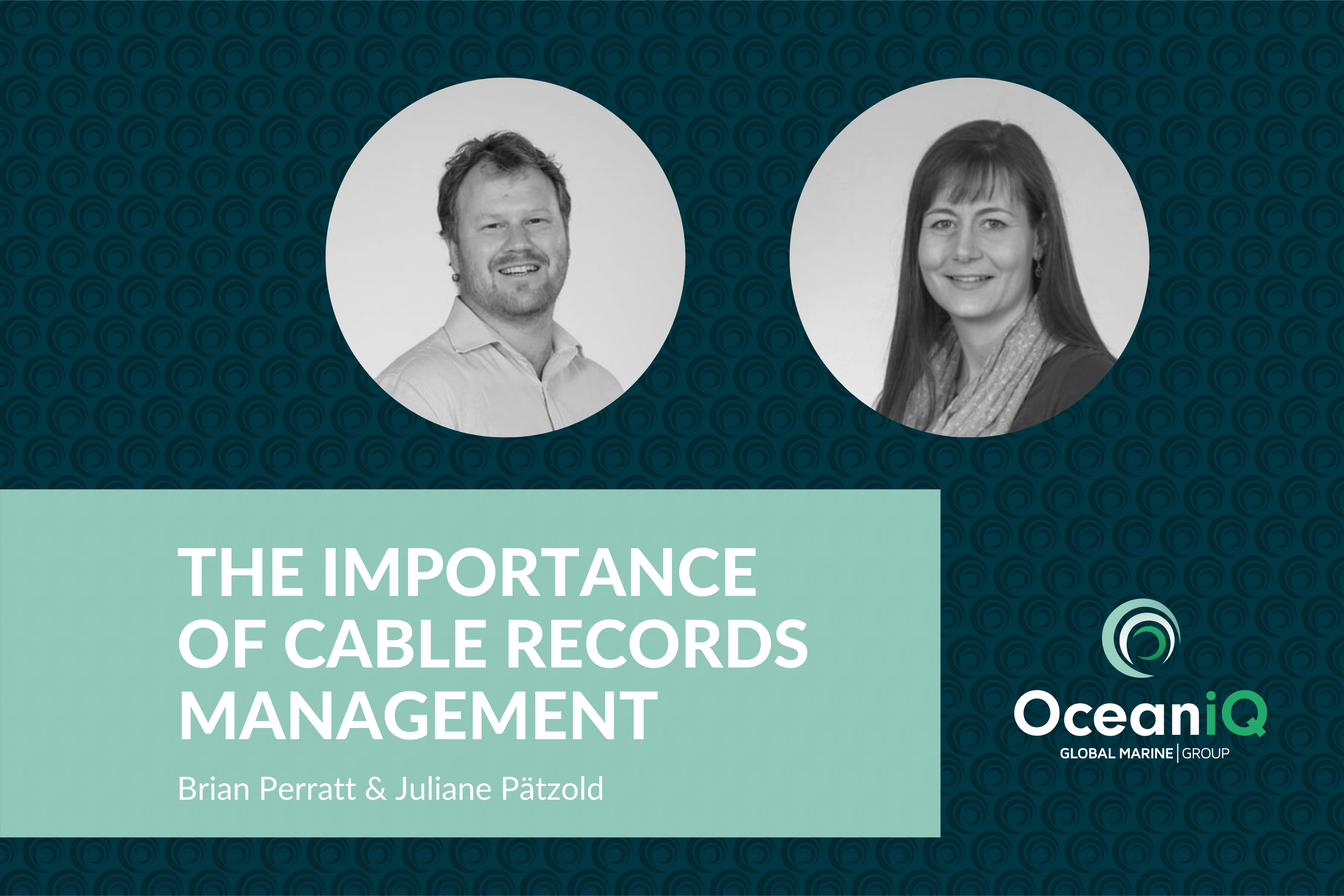
In this discussion, OceanIQ’s experts Brian Perratt and Juliane Pätzold discuss the importance of subsea cable records storage and management, and the obstacles that clients and seabed users can face if data isn’t properly maintained. Records management is the systematic control of the creation, maintenance, use,...
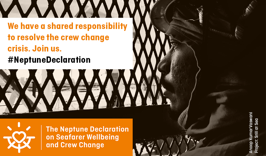
Global Marine Group, along with over 450 other organiations have joined forces to help resolve the humanitarian crisis affecting seafarers globally. Global industry and human rights leaders, including A.P. Møller – Mærsk, BP, BW, Cargill, COSCO, DOW, Euronav, MISC Group, NYK, Rio Tinto, Shell, Trafigura, Unilever...
Accurate and up-to-date data can help minimise project downtime and associated cost Having access to accurately mapped submarine cable routes has become essential following the increase in seabed usage from industries such as telecoms, renewable energy, oil & gas and resource mining. Records management is the...
OceanIQ’s parent company, the Global Marine Group (GMG), was appointed by Vattenfall to deliver the route clearance and cable installation campaign at Danish Kriegers Flak, an offshore wind farm located in the Baltic Sea, southeast of Copenhagen. The new development consists of 72 turbines linked to...
OceanIQ is extremely excited to announce the appointment of Mitch Cheney as Business Development Director at OceanIQ. Mitch joins at an exciting time for the newly launched business unit and will be helping to take the business direct to market and identifying opportunities for significant market...
To connect a cable from one landing point to another is no mean feat, and one that is made more difficult due to the plethora of obstacles and challenges presented not only by the marine environment but by human hands too. Careful consideration of all the...
Global Marine Group (GMG) a leading provider of subsea cable installation and maintenance services to the telecommunications, offshore renewables, utility and oil & gas markets worldwide, is pleased to announce the launch of OceanIQ, the third business unit in Global Marine Group’s subsea engineering portfolio. OceanIQ...

We’re looking for an Assistant Survey & Route Engineer to support in the technical aspects of cable survey tendering as well as marine survey delivery. The individual will assess and adjustment survey specifications to suit project needs so they optimise the ability to design submarine power...
Global Marine, a leading provider of subsea fibre optic cable installation and maintenance solutions to the telecoms sector, and part of the Global Marine Group, has been awarded the Desk Top Study (DTS) for the Singapore India Gateway (SING) cable system by the system Purchasers. The...
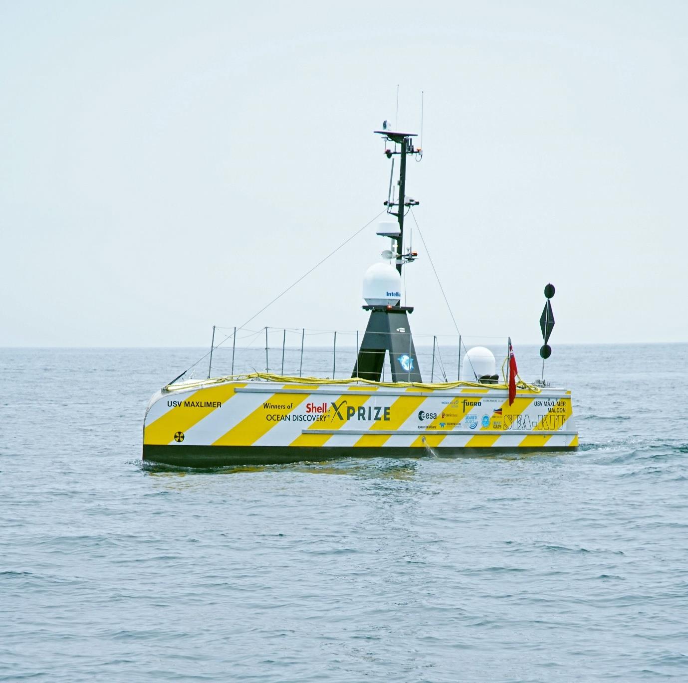
We’re pleased to share this exciting press release from SEA-KIT celebrating the return of an uncrewed USV following a 22 day mission in the Atlantic. The collaborative project which Global Marine Group were a part of has successfully demonstrated the potential for over-the-horizon, long endurance, remote...
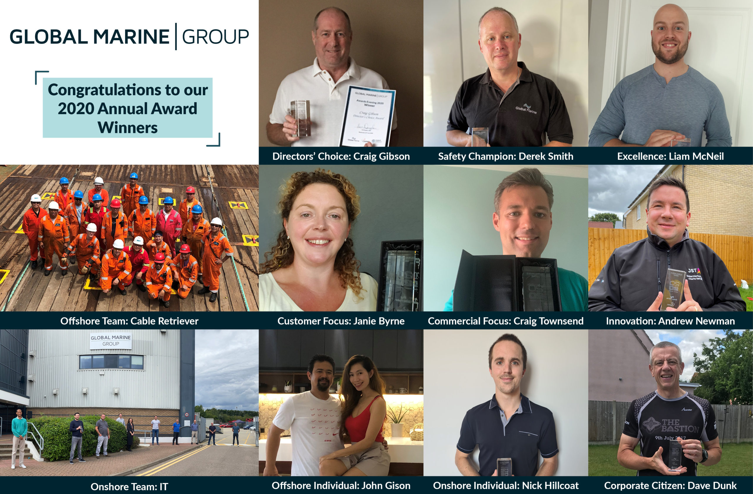
We recently celebrated our annual awards to recognise some of the shining stars within our team right across the world. From over 130 peer nominations, we announced the winners in each of the 11 categories. Offshore Individual: John Gison Chief Officer, John, was chosen at the winner...
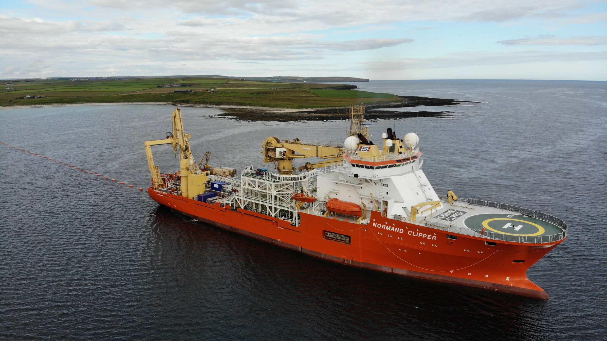
Global Offshore is pleased to share Scottish & Southern Electricity Networks’ latest press release regarding the start of works on this important cable replacement project. Following route survey, data collection and various studies completed by Global Offshore in 2019, our team are soon to begin the cable installation...
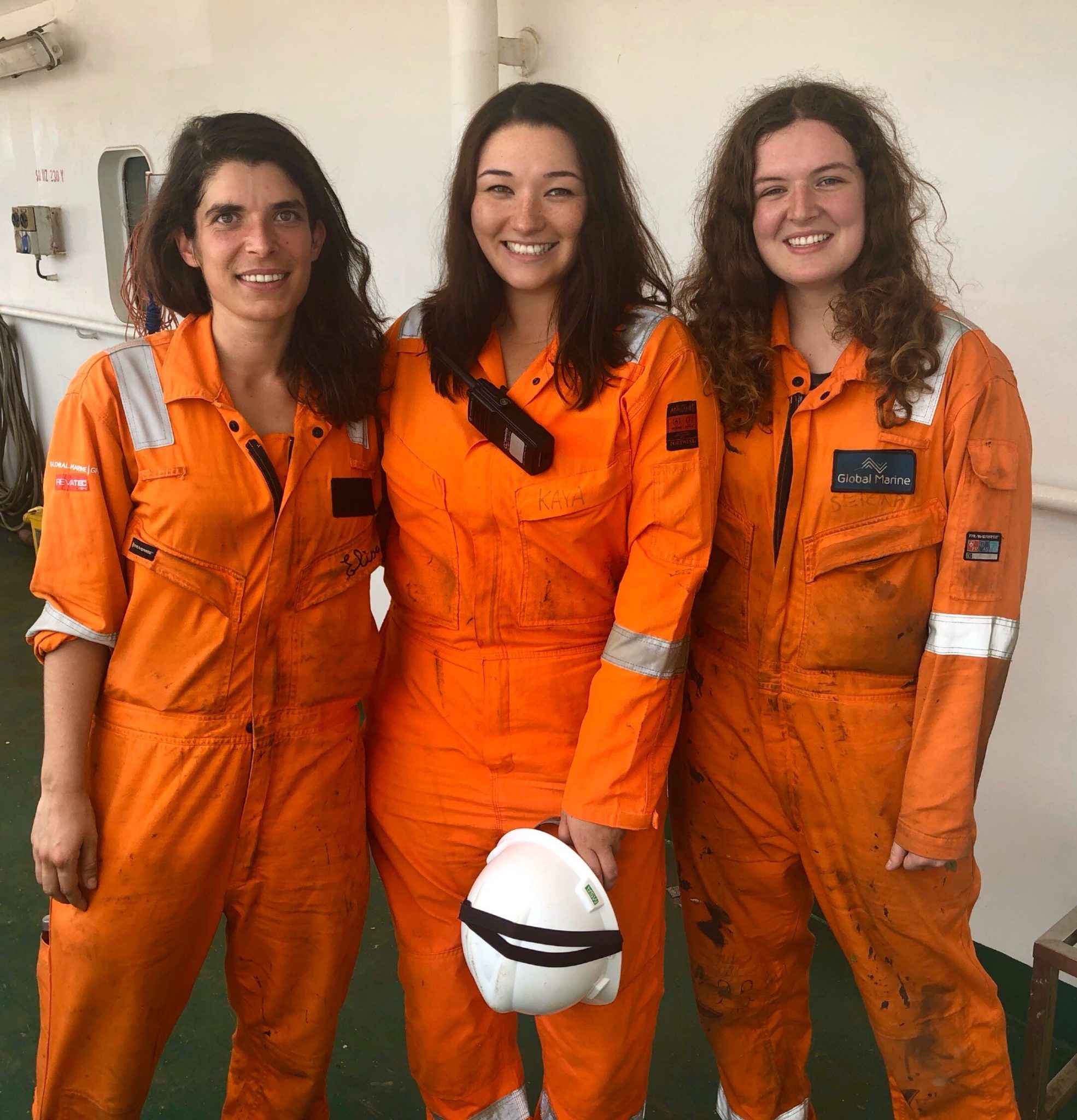
International Women in Engineering Day (#INWED20) takes place on 23 June with the theme of ‘Shape The World’. We hope by sharing some of Global Marine Group’s success stories, we can help to raise the profile of women engineers across the globe, and encourage more people...

International Women in Engineering Day (#INWED20) takes place on 23 June with the theme of ‘Shape The World’. We hope by sharing some of Global Marine Group’s success stories, we can help to raise the profile of women engineers across the globe, and encourage more people...
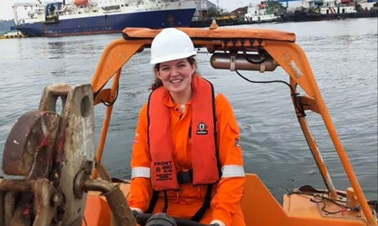
(Centre in Photo) International Women in Engineering Day (#INWED20) takes place on 23 June with the theme of ‘Shape The World’. We hope by sharing some of Global Marine Group’s success stories, we can help to raise the profile of women engineers across the globe, and...
As the COVID-19 pandemic continues to affect businesses and individuals globally, like everyone, we’ve been adapting as an organisation to ensure that we can continue to deliver important services to our valued customers, minimising the impact on their operations and projects. We continue to follow UK and local Government guidelines...
In light of recent developments and UK Government guidelines, we wanted to update our customers, suppliers and stakeholders about the measures we are taking to cope with the effects of COVID-19. We are following UK and local Government guidelines as well as public health advice as...

Global Marine Group (“GMG” or the “Company”), a leading provider of subsea cable installation and maintenance services to the telecommunications, offshore renewables, utility and oil & gas markets worldwide, is pleased to announce an affiliate of J.F. Lehman & Company (“JFLCO”), a leading middle-market private equity...
The Global Marine Group is extremely pleased to announce that an agreement has been reached between HC2 and J.F. Lehman & Company with regards to the 100% sale of the company. The transaction is subject to customary closing conditions being met, and is expected to close...
An international Ocean Renewable Energy Action Coalition has been formed to advance sustainable deployment of ocean-based renewable energy and mitigate the harmful impacts of climate change. Ocean based renewable energy – such as offshore wind, floating solar, tidal and wave power – could meet nearly 10%...

Global Offshore is pleased to share RenewableUK’s latest press release regarding the appointment of a new Shadow Board, including our Director of Marketing, Gail Clark. RenewableUK is setting up a Shadow Board, made up of rising stars in the clean energy sector, to provide a greater range of...
Global Offshore, a leading provider of cable installation, repair and trenching services to the offshore renewables, utilities and oil & gas markets, will be working with Scottish and Southern Electricity Networks (SSEN) on their Pentland Firth East power cable installation project. The Pentland Firth is a...
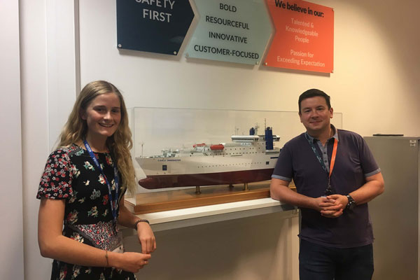
For the last couple of weeks, Megan, an A level student from Great Baddow High School in Chelmsford, has been undertaking work experience within our Engineering Team based at our Head Office. As an engineering organisation, we strongly advocate participation in STEM (science, technology, engineering and...

In an era characterised by swift technological progress and digital interconnectivity, it is paramount to involve and empower the upcoming cohort of young professionals in shaping the trajectory of our industry. This endeavour is not only crucial for the overall expansion of knowledge and expertise within...